Pakistan's Grand Trunk Road is best understood as a corridor repeatedly repaired, redirected and reinterpreted, not one untouched ancient strip of paving. Forts, caravanserais, markets and later transport infrastructure reveal how movement reorganised settlement across the upper Indus plain.
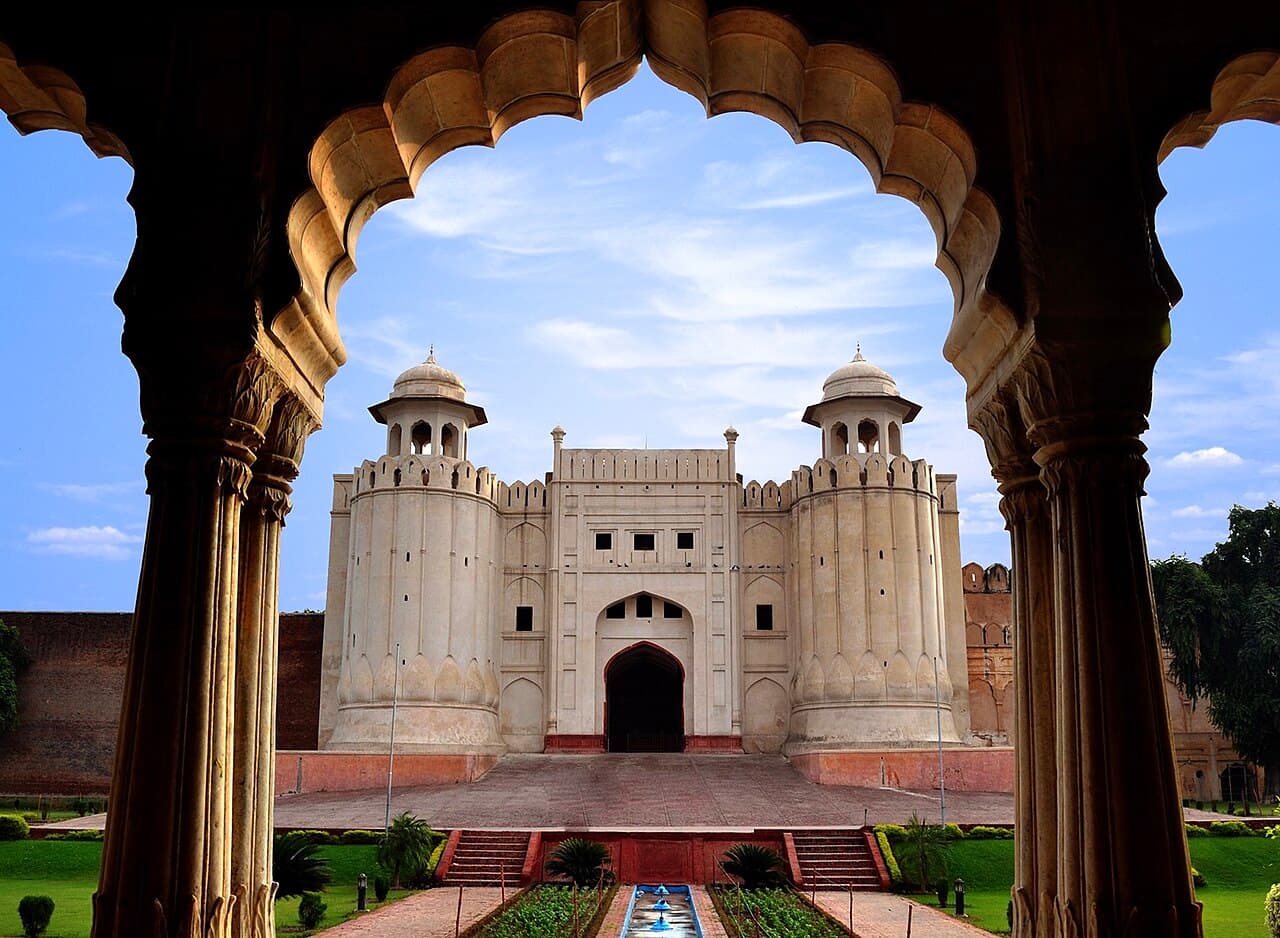
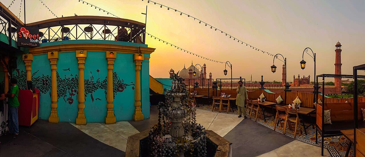
The cover photograph shows Badshahi Mosque in Lahore, a heritage landmark in one of the corridor's major cities. It illustrates the route's urban historical setting rather than the road surface itself.
At a glance
Start here
- Keep the historic Grand Trunk Road concept separate from the modern N-5 legal highway alignment.
- Use Rohtas and Rewat to compare a major fortress with a smaller fortified caravanserai.
- Read Peshawar's Qissa Khawani Bazaar as a place of exchange and storytelling, not a frozen stage set.
- Treat roadside buildings and towns as evidence of changing mobility rather than distractions between famous monuments.
01
The historic road is not one continuous visitor route
The Grand Trunk Road's cultural story continues toward Nowshera and Peshawar, but current advisories break any simple end-to-end itinerary. The UK FCDO advises against all travel to Peshawar and against all but essential travel to Nowshera and Mardan. Australian and US advice applies a do-not-travel level to most or all of Khyber Pakhtunkhwa. These boundaries turn the northern stretch into a subject for desk research for many foreign visitors.
Consult the advisory tied to your nationality, Pakistani permission requirements and insurance before planning any segment. The warnings cannot be solved by hiring a local driver or arranging an informal escort. Where advice says not to travel, use this article to read maps, monuments and road history without going there. Build any physical itinerary only from segments that remain permitted and supported by current official guidance.
Sources: UK Foreign, Commonwealth and Development Office; Australian Department of Foreign Affairs and Trade; United States Department of State02
The road is a historical process, not a single line
UNESCO's official Tentative List material for sites along the wider Grand Trunk tradition describes a route known through names including Uttarapath, Badshahi Sadak and Sadak-e-Azam, with major rebuilding under Sher Shah Suri and continued Mughal use. That submission belongs to India, so it does not designate Pakistani sites. It is used here only for the transregional history of the road tradition.
Within Pakistan, surviving places show different route functions: Rohtas controlled movement at monumental scale; Rewat combined lodging and defence; market streets supported exchange; bridges, railways and the modern highway later altered mobility again. A historical road is therefore a bundle of alignments and institutions whose importance persists even where an old surface has vanished.
- Ancient and medieval route traditions provide the long-distance frame.
- Fortification and caravan facilities reveal security and provisioning.
- Markets and towns show how repeated movement creates urban culture.
- Modern highway and rail networks are later layers, not proof of an identical alignment.
03
Use the N-5 as a modern reference with limits
The National Highway Authority Act schedule identifies N-5 through Karachi, Hyderabad, Multan, Lahore, Jhelum, Rawalpindi, Peshawar and Torkham. This legal description supplies a modern national corridor. It does not establish that every kilometre follows a historic Grand Trunk alignment or that current journeys will take a particular amount of time.
That distinction prevents two common errors: labelling any N-5 roadside structure as Grand Trunk heritage and treating a historic route article as live navigation. Use current mapping, road advisories and local directions for travel. Use dated archaeology, architecture and documentary evidence to explain the past. Where the two records overlap, call it continuity or proximity only when a source supports the relationship.
Sources: National Highway Authority, Pakistan04
Rohtas turns movement into military architecture
Rohtas Fort stands near Jhelum and is approached from the Grand Trunk Road according to Pakistan's Department of Archaeology and Museums. UNESCO dates the vast fortified complex to the sixteenth century and recognises it as World Heritage. Its walls, gates and bastions express control of terrain and passage at a scale far beyond a roadside rest stop.
Read the gates as technologies of movement. Their approaches, turns, openings and decoration demonstrate that circulation could be filtered and staged. The fort's baolis add the practical water system required to support occupation. Linking those details to the corridor is more informative than simply calling Rohtas a landmark on the way between two modern cities.
- Compare more than one gate because approaches and architectural treatment differ.
- Include the wall circuit and terrain in photographs to show defensive scale.
- Keep World Heritage status attached to Rohtas, not transferred to the road as a whole.
05
Rewat reveals the guarded overnight stop
Pakistan added Rewat Fort to its UNESCO Tentative List in 2026. The entry identifies it as a fifteenth-century fortified caravanserai on the historic Grand Trunk Road, with a central courtyard, cells, mosque and tomb. Its combination of lodging and enclosure shows how long-distance movement required organised stopping places.
Rewat's status must be stated carefully: it is a Tentative List property, not World Heritage. Its value in this story is comparative. Rohtas demonstrates large-scale strategic fortification; Rewat demonstrates the more compact architecture of protection, accommodation and exchange. Together they make the corridor's operational needs visible at two scales.
Sources: UNESCO World Heritage Centre06
At Peshawar, the corridor becomes conversation
Pakistan's official tourism portal describes Qissa Khawani Bazaar as an old Peshawar market associated with trade and storytelling and places it within the city's wider Silk Road history. The bazaar reminds readers that a route carried language, news, food, finance and performance as well as armies and goods.
It remains an active urban place rather than a heritage exhibit arranged for visitors. Observe commercial rhythms without blocking shops or treating working people as props. Ask before portraits, purchase before requesting lengthy demonstrations and avoid claiming that a present business has a particular antiquity unless documentation supports it. The living street is evidence of continuity and change, not a portal untouched by modern life.
Sources: Pakistan Tourism Development Corporation, Salam Pakistan07
Railways and civic buildings add later mobility layers
Pakistan Railways publishes an official network map and lists stations including Lahore, Jhelum, Rawalpindi, Peshawar and Nowshera in its general information. The railway created another long-distance system through many corridor cities, but an official network map does not prove that rails reproduce the older road mile for mile.
At Nowshera, the federal archaeology record for the 1920s Taj Building places a protected civic-era structure on the Grand Trunk Road and notes its blended Roman, Gothic and Oriental architectural features. That later building widens corridor heritage beyond forts. Repeated mobility produces offices, residences, stations, shops and new architectural vocabularies as well as monuments associated with dynasties.
- Use the railway map for network context, then check live services separately.
- Record ordinary street architecture before redevelopment erases its relationship to the road.
- Do not trespass or obstruct traffic while documenting roadside buildings.
08
Travel a short transect instead of claiming the whole road
Choose a compact question-led segment: gates and control around Jhelum and Rohtas; caravan architecture around Rewat and Rawalpindi; or trade and later civic layers toward Peshawar and Nowshera. A focused transect allows time to compare evidence without presenting a multi-province drive as effortless.
For every stop, record the source that connects it to the corridor and the status of that evidence. Modern N-5 location, historic-road association, World Heritage inscription and Tentative List entry are different claims. Keeping them separate turns a familiar road name into a rigorous account of how Pakistan's settlements absorbed centuries of movement.
Sources: National Highway Authority, Pakistan; UNESCO World Heritage Centre; Department of Archaeology and Museums, Government of PakistanUseful answers
Reader questions
Is the modern N-5 identical to the historic Grand Trunk Road?
No such identity is claimed here. The NHA schedule defines today's N-5 corridor, while historical and archaeological sources identify particular Grand Trunk associations. Alignments can overlap, diverge and change.
Sources: National Highway Authority, Pakistan; UNESCO World Heritage CentreIs Rewat Fort a UNESCO World Heritage Site?
No. Pakistan submitted Rewat Fort to the UNESCO Tentative List in 2026. Rohtas Fort is the inscribed World Heritage property discussed in this article.
Sources: UNESCO World Heritage Centre; UNESCO World Heritage CentreDoes the Pakistan Railways map provide current train times?
No. It supplies official network context. Consult Pakistan Railways' live booking or timetable tools for a dated journey and do not infer a service from the static map.
Sources: Ministry of Railways, Government of Pakistan; Pakistan RailwaysRead the evidence
Sources and further reading
These sources support the relevant sections above. Plans and comparisons are editorial suggestions. Check operators for current arrangements.
- Sites along the Uttarapath, Badshahi Sadak, Sadak-e-Azam, Grand Trunk Road ↗UNESCO World Heritage Centre · Accessed 14 September 2026
Transregional road names and broad development under Sher Shah Suri and the Mughals; this is India's submission and does not designate Pakistani sites.
- The National Highway Authority Act, 1991 ↗National Highway Authority, Pakistan · Accessed 14 September 2026
Official modern N-5 city sequence from Karachi through Lahore, Jhelum, Rawalpindi and Peshawar to Torkham.
- Rohtas Fort ↗Department of Archaeology and Museums, Government of Pakistan · Accessed 14 September 2026
Rohtas location and official approach relationship to the Grand Trunk Road.
- Rohtas Fort ↗UNESCO World Heritage Centre · Accessed 14 September 2026
World Heritage status, chronology, walls, gates, bastions, baolis and architectural significance.
- Rewat Fort ↗UNESCO World Heritage Centre · Accessed 14 September 2026
2026 Tentative List status, fifteenth-century fortified caravanserai identification and courtyard, cells, mosque and tomb.
- Qissa Khawani Bazaar ↗Pakistan Tourism Development Corporation, Salam Pakistan · Accessed 14 September 2026
Official tourism account of the Peshawar bazaar's trade, storytelling and Silk Road context.
- Map of Pakistan Railways ↗Ministry of Railways, Government of Pakistan · Accessed 14 September 2026
Existence of an official national railway network map; not used for schedules or exact historic-road alignment.
- General Information ↗Pakistan Railways · Accessed 14 September 2026
Named railway stations in corridor cities, without a claim about a current particular service.
- Taj Building ↗Department of Archaeology and Museums, Government of Pakistan · Accessed 14 September 2026
Nowshera Grand Trunk Road location, 1920s date and mixed architectural vocabulary of a later protected building.
- Regional risks - Pakistan travel advice ↗UK Foreign, Commonwealth and Development Office · Accessed 14 September 2026
Nationality-specific British advice for Balochistan, Khyber Pakhtunkhwa, Peshawar, Mardan, Nowshera and the India border.
- Pakistan Travel Advice and Safety ↗Australian Department of Foreign Affairs and Trade · Accessed 14 September 2026
Nationality-specific Australian advice to reconsider Pakistan overall and not travel to Balochistan, most of Khyber Pakhtunkhwa or specified border areas.
- Pakistan Travel Advisory ↗United States Department of State · Accessed 14 September 2026
Level 3 advice for Pakistan and Level 4 advice for Balochistan and Khyber Pakhtunkhwa, plus permission requirements.