Pakistan's wetlands can be read as a north-south atlas of water: high lakes, saline basins, river barrages, floodplain systems, delta creeks and offshore islands. Together they reveal the country through hydrology and migration rather than provincial capitals or a greatest-hits landscape list.
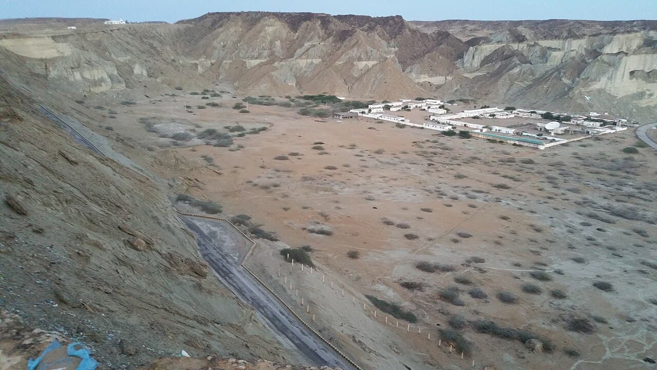
The Ramsar Sites Information Service records nineteen Wetlands of International Importance for Pakistan. The cover photograph shows Hingol National Park as broad arid and coastal Balochistan context, not a named Ramsar wetland.
At a glance
Start here
- Pakistan's nineteen Ramsar sites represent very different wetland types, not one interchangeable habitat.
- The Indus Delta is a large creek, mudflat, saltmarsh, lagoon and mangrove system shaped by freshwater and sediment flows.
- The Uchhali lakes show how saline wetlands fit inside the Salt Range's dry geology.
- Official bird counts are dated monitoring snapshots, not promises about what a visitor will see.
01
Keep Astola on the map, not on an itinerary
Astola Island belongs in a national wetlands comparison, but it lies off Balochistan. Current British, Australian and US advice says not to travel to Balochistan; the UK and Australian pages also emphasize kidnapping and security risks, and the US advisory assigns the province Level 4. This article therefore uses Astola as a desk-based ecological case, not as a boat-trip suggestion.
Do not infer permission, marine safety or acceptable travel from a conservation designation. Check the advisory for your nationality, Pakistani authority requirements and live maritime warnings. A boat operator's willingness to depart does not override official travel advice or create protected-area permission. If the warnings remain, compare Astola's ecological record with accessible wetland interpretation elsewhere and leave the island unvisited.
Sources: UK Foreign, Commonwealth and Development Office; Australian Department of Foreign Affairs and Trade; United States Department of State02
Read wetland types before plotting destinations
Ramsar's annotated Pakistan list spans mountain lakes, river and barrage wetlands, saline lake complexes, coastal systems and islands. Its national total of nineteen sites is useful, but the diversity behind that number matters more. A high-altitude lake and a mangrove creek cannot be visited, interpreted or protected in the same way.
Build a mental transect instead of an itinerary that claims to cover the country. Ask four questions of each place: where the water comes from, how its level or salinity changes, which human systems depend on it and which species use it seasonally. The answers locate the wetland within a functioning landscape rather than reducing it to a birdwatching pin.
- Source: rainfall, snow and ice, river flow, groundwater, tides or a combination.
- Form: lake, marsh, floodplain, barrage, creek, mangrove or island coast.
- Pressure: altered flow, sediment change, extraction, pollution, disturbance or invasive species.
- Use: habitat, fisheries, agriculture, flood moderation, livelihoods or cultural meaning.
03
Northern water begins with elevation and catchment
The national Ramsar list includes high-altitude sites such as Sheosar Lake and the Deosai Plains. Their presence expands the ordinary image of a wetland beyond lowland reeds. In elevated landscapes, snow and catchment processes shape water availability, while short productive seasons concentrate ecological activity.
A responsible visitor keeps to designated tracks and official local guidance because apparently bare ground can hold fragile vegetation or saturated soil. Do not infer universal road access from designation alone. Ramsar status identifies ecological importance; it does not guarantee a transport service, an open season or visitor facilities. Those mutable details require current regional confirmation.
Sources: Ramsar Sites Information Service04
Saline lakes interrupt the Salt Range
The Uchhali Complex consists of three saline to brackish lakes within Punjab's Salt Range and covers 1,243 hectares according to Ramsar's annotated list. The lakes support important wintering waterbirds. Their chemistry and closed-basin setting make them a distinctive ecological system, not a generic freshwater picnic landscape.
This setting also joins geological and biological stories. Water interacting with a salt-rich range creates habitat with specific tolerances and seasonal use. Observation should be quiet and distant, with no expectation of approaching flocks. Species presence changes, so a designation or old photograph never guarantees a sighting on a particular morning.
Sources: Ramsar Sites Information Service05
Barrages turn the Indus corridor into linked habitat
Ramsar entries along the Indus include sites associated with barrages and reservoirs, demonstrating how engineered water infrastructure and habitat now overlap. These places can hold fisheries, floodplain ecology and migratory-bird use within working river systems. They should not be described as untouched wilderness.
Pakistan EPA's Year Book 2023-24 records the annual mid-winter waterfowl census as a monitoring activity conducted since 1982 and reports surveys across Khyber Pakhtunkhwa, Punjab and Sindh for that year. Such counts are valuable because they create dated evidence. They are not a live population total, and this article does not turn the 2023-24 result into a 2026 wildlife promise.
- Read any bird count with its survey year and geographic coverage.
- Keep distance from roosts, nesting areas and fishing work.
- Use local site rules for boating, access and photography rather than assuming uniform Ramsar rules.
06
At the delta, freshwater meets tide and sediment
The Ramsar information sheet for the Indus Delta describes a 472,800-hectare system with seventeen major creeks, mudflats, saltflats, marshes, lagoons and mangrove habitat. These features are connected. Freshwater and sediment moving downstream meet tides and salinity, shaping the form and productivity of the coast.
A mangrove visit should therefore be explained as entry into a dynamic estuary, not simply a boat ride through trees. Use an authorised operator, follow local restrictions and avoid disturbing banks or wildlife. Do not state that every creek is accessible or safe on the basis of a site inventory. Tides, weather, boat condition and permissions are operational facts to verify for the chosen date.
Sources: Ramsar Sites Information Service07
Astola carries the atlas offshore
Ramsar's Pakistan list includes Astola Island, while Pakistan's official tourism portal identifies it as the country's largest offshore island in the Arabian Sea and highlights its ecological character. The island extends the wetland story beyond river mouths to a marine and coastal setting off Balochistan.
Remote designation is not an invitation to improvise access. Weather, sea state, landing conditions, protected-species needs and operator capability can all matter. The tourism page supports the island's identity and broad ecological value but not a permanent departure schedule. Travellers should use current official and local information and accept that responsible conditions may rule out a landing.
Sources: Ramsar Sites Information Service; Pakistan Tourism Development Corporation, Salam Pakistan08
Turn observation into a low-impact practice
Keep a wetland log that records date, general location, habitat, weather and observation distance. Identify species only when evidence supports the identification; an unknown wader is better than a confident error. Avoid playback, feeding and close pursuit. If local livelihoods are visible, do not frame people as intruders in a landscape where fishing, farming and water management may be integral.
The atlas approach produces a more honest national picture. Pakistan's wetlands are not spare scenery between mountains and cities. They are connected to river engineering, groundwater, salt geology, seasonal migration, coastal processes and livelihoods. Seeing those relationships is the point, even if a traveller visits only one accessible site and leaves the rest to careful research.
- Take litter out, including food scraps and fishing-line fragments encountered in personal use.
- Use binoculars or a long lens instead of reducing distance to wildlife.
- Never remove shells, eggs, plants or other natural material.
Useful answers
Reader questions
How many Ramsar sites does Pakistan have?
The Ramsar Sites Information Service annotated list records nineteen Wetlands of International Importance in Pakistan. This is a designation count, not a count of every wetland in the country.
Sources: Ramsar Sites Information ServiceAre the official waterfowl counts current wildlife guarantees?
No. The EPA yearbook reports a dated 2023-24 monitoring programme and results. Counts vary by survey period, coverage and ecological conditions and cannot promise a 2026 sighting.
Sources: Pakistan Environmental Protection AgencyDoes Ramsar status guarantee visitor access?
No. Ramsar designation recognises international ecological importance. Current roads, boats, permissions, seasonal restrictions and visitor facilities must be checked for the particular site.
Sources: Ramsar Sites Information ServiceRead the evidence
Sources and further reading
These sources support the relevant sections above. Plans and comparisons are editorial suggestions. Check operators for current arrangements.
- Annotated List of Wetlands of International Importance: Pakistan ↗Ramsar Sites Information Service · Accessed 14 September 2026
National total of nineteen Ramsar sites and official summaries for alpine, saline, riverine, coastal and island wetlands.
- Information Sheet on Ramsar Wetlands: Indus Delta ↗Ramsar Sites Information Service · Accessed 14 September 2026
Indus Delta area, seventeen-creek system and mudflat, saltflat, marsh, lagoon and mangrove habitat.
- Year Book 2023-24 ↗Pakistan Environmental Protection Agency · Accessed 14 September 2026
Annual mid-winter waterfowl census history and dated 2023-24 monitoring coverage; not treated as a live count.
- Astola Island ↗Pakistan Tourism Development Corporation, Salam Pakistan · Accessed 14 September 2026
Official tourism identification of Astola as Pakistan's largest offshore island and its broad Arabian Sea ecological context.
- Regional risks - Pakistan travel advice ↗UK Foreign, Commonwealth and Development Office · Accessed 14 September 2026
Nationality-specific British advice for Balochistan, Khyber Pakhtunkhwa, Peshawar, Mardan, Nowshera and the India border.
- Pakistan Travel Advice and Safety ↗Australian Department of Foreign Affairs and Trade · Accessed 14 September 2026
Nationality-specific Australian advice to reconsider Pakistan overall and not travel to Balochistan, most of Khyber Pakhtunkhwa or specified border areas.
- Pakistan Travel Advisory ↗United States Department of State · Accessed 14 September 2026
Level 3 advice for Pakistan and Level 4 advice for Balochistan and Khyber Pakhtunkhwa, plus permission requirements.